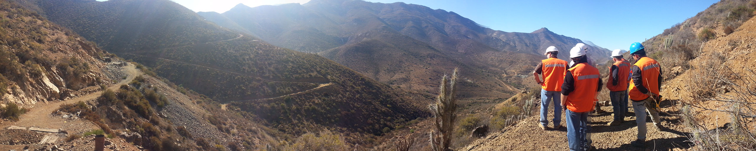
Representation for the negotiation and development of projects. We manage the approach of the owner of the mining property and the investor.
Investor
To the investor we facilitate the entry to the Chilean mining market. We advise and support you in the search of prospects, projects and businesses in Chile. Our job is to be the first filter, providing a list with real potential for the investor. Later we can offer the administration, management and development service of your exploration project
.
Small and medium miner
We advise the owner of the mining property in the development of his project with the aim of advancing in value. We make a technical and economic evaluation, we value the asset and we propose an explorations plan or business case, as applicable, eliminating what does not add value.


Lista de PROYECTOS Espiga
|
ID ESPIGA |
GENERAL INFORMATION |
GEOLOGY AND MINERALIZATION |
WORK DONE |
|
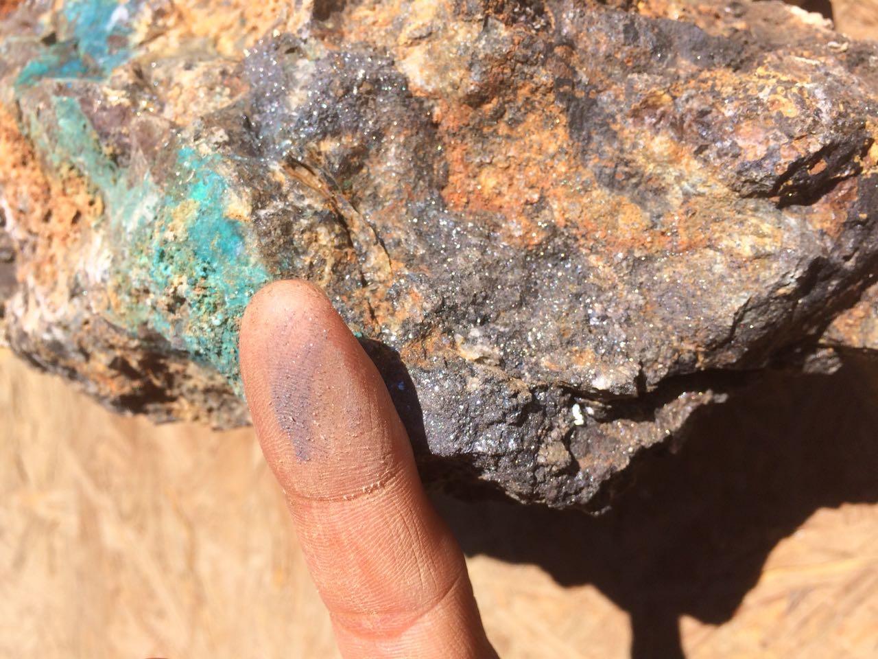
ESP – 01 Cu (Ag) |
An old underground mine located 800 km N of Santiago
city and 41 km SE of Copiapo city. Located in an active mining sector, with ore
processing plants nearby (Elisa de Bordos, ENAMI, others) for the sale of ROM
or concentrate. It has access to infrastructure, energy and the
supply chain. There are ten tenements covering about 2,800 ha. |
The deposit is located in the fault “Elisa de
Bordos”, a structure being exploited by several mines, between Elisa de
Bordos and Cerro Blanco. This fault contacts the Cerrillos
(Middle Cretaceous) and Hornitos (Upper Cretaceous) formations. The ore is
found in a 0.5–3.0 m wide manto, with NE
orientation, and inclined 30–40° to the SE. Mineralization is located between
the upper calcareous sediments, lower tuffs and pyroclastic rocks, mainly
consisting in chalcocite and, secondarily, bornite. |
The mine has been exploited since more than one
century ago, so it counts with several geology and exploration studies made
by authors such as Walther Eberle (1998), Mayer & Fontbote,
and Harry Floyd (2006). The Chilean company Pucobre
conducted geophysics and a drilling campaign in the period 2004–2005. A geology study was made in November 2014 by an independent
consultant. Fresnillo PLC took 40 samples and the lab results showed good results for
copper and silver, where 25% of samples gave 1.0–5.5% Cu and 120–520 g/t Ag. The mine was exploited again during 2015 and the ore
was sold to the processing plant of ENAMI Matta. Exploitation was suspended
due to a drop in metal pricing. |
|
ESP – 02 Cu – Au – Ag |
Located in the Province of Limari,
IV Region, 150 km W of Coquimbo city, and at an altitude of 3,880 masl. The mining property covers an area of 1,550 ha. |
The ore is composed of several structures, veins, mantos and outcroppings that could correspond to
mineralized bodies of stockwork type. Vein type
structures show significant widths. The main vein is about 10 m wide,
oriented N50°/45°SW and with a significant running length of about 1000 m,
mainly recognized through surface labors. |
Geophysics: 85 km of linear magnetometry. Successful surface sampling: 32 samples taken,
giving results up to 9% Cu and 1,360 g/t Ag. There were19 samples resulting in >1% Cu; 16
containing >200 g/t Ag, and four showing >0.5g/t Au The junior Canadian company QS Capital, signed a
purchase option for this project, during the period 2012 -2013. |
|
ESP – 03 Cu (Au) |
Located in the Atacama Region, 95 km NE of Copiapó city, at an altitude of 2800 masl.
Property extends 2,920 ha. There are 320 ha of
exploitation concessions and 2,600 ha in surveying process. Previous artisanal miners have mined approximately
100.000 ton with grades over 2% Cu, focusing on the oxidation zone at shallow
levels. |
The project belongs to the gold-silver
epithermal/gold-copper porphyry Maricunga belt at the
NE of the Chilean Andes. The mineralization consists of a complex copper-rich
system that includes stockworks, dissemination,
hydrothermal breccias and sulphide-rich veins with
economic contents of gold and silver. Silicic-argillic alteration is
intensely widespread in the whole area. The old mine presents a 2 km x 300 m long mineralized
structure that includes grades of 1.0-1.5% Cu and 0.3-4.0 g/t Au. Mineral
assemblage is represented by chalcocite, bornite, chalcopyrite, covellite,
pyrite, hematite and magnetite. Recent resource potential estimate using underground
and surface data integration, geochemical survey and IP-resistivity models,
indicate a mineral potential of 200 Mt. |
Geophysics: Induced polarization and resistivity.
Exploration magnetometry. Report on geology 48 chip samples The junior Australian company Laguna Resources,
signed a purchase option for this project, during the period 2011 -2014. |
|
ESP – 04 Au – Cu |
Located 25 km SE of Ovalle city and 10 km E of Punitaqui town, at an altitude of 900 masl. Mining property covers 100 ha, but other properties
with excellent mining potential could be incorporated in the near future.
These properties are being targeted. Project is located in an attractive zone in terms of
exploration potential, and also at the vicinity of ore processing plants and
purchasing centers to get mining supplies. It is highly feasible to start a mining operation of
5,000 tpm in the near term. |
Au-Ag-Cu vein type mineralization hosted by Lower
Cretaceous meta andesites and granitic rocks of dioritic
and granodioritic compositions. The alteration halo in the Au-Ag-Cu veins in
San Lorenzo presents a widespread strong argillization
bordering veins, consisting mainly of kaolinite with minor proportions of
montmorillonite and adularia-sericite assemblage, and restricted root zones
of silicified envelopes. Chloritic or propylitic alteration represent the peripheral
alteration. Mineralogy reflects a distal epithermal halo, from
similar enriched proximal ores like in Punitaqui
district, consisting of quartz, specularite,
hematite, pyrite, chalcopyrite, calcite, gold, silver and magnetite. |
Surface mapping, sampling and chemical analysis. Geochemical results on San Lorenzo veins indicate
important anomalies of Au (up to 1.03 ppm), Ag (up to 11 ppm), Cu (up to 0.57%),
Mn (up to 4830 ppm), V (up to 1102
ppm), As (up to 482 ppm), Sb (up to 3600 ppm) and Fe (4.99-42.76%). |
|
ESP – 05 Cu |
Located 75 km S of Copiapo
city, Atacama Region, immediately east of Route 5 and at an altitude of
520–560 masl. There is easy access to energy, equipment supplies,
fuel and services. The mining property has an area of 2,400 ha. The Project comprises two ore deposits in the same
project area: An iron ore deposit corresponding to the known iron belt of
Atacama Zone and a Porphyry Cu (Au) ore deposit. |
Tertiary porphyry belt. Copper sulfide mineralization, disseminated, stockworks and hydrothermal breccias, leading to a Phy-Cu target. Copper: Estimated potential >400 million tons at
0.5–0.8% Cu. |
During 2013, three DDH holes, totalizing 500 m, were
done, giving successful results. These were made to verify a geophysical
anomaly targeted, marked by extensive zones of hydrothermal alteration,
represented by sericite and quartz in stockwork,
with abundant disseminated magnetite and sulfide mineralization, mainly
pyrite. This style of alteration is characteristic of porphyry copper
deposits. |
|
ESP – 05 Fe |
Ferriferous belt, Cretaceous (Fe -apatite): Iron ore
deposit (W side of mining properties) > 1 km long NS x 300 m wide EW; massive
bodies of magnetite
and a minor participation of hematite. Estimated potential >100 million tons at 40-45%
Fe; Magnetite > Hematite. |
||
|
ESP – 06 Au (Cu – Ag) |
The project is located 45 km NE Inca de Oro town and
160 km NE of Copiapó city. The mining property covers 1,700 ha. It is feasible to advance a short term Project involving the high grade ore in the
breccias (5Mt) |
A well-known mining area of approximately 2 km2
including numerous mineral occurrences of high grade Au-Cu-Ag, consisting of quartz
veins, stockwork, sulphide
dissemination and hydrothermal breccias. The hydrothermal alteration includes
intense silicification and argillic alteration associated to epithermal veins
and hydrothermal breccias with disseminations and overgrowth of argentite,
chalcocite, bornite, chalcopyrite and pyrite. The economic potential relates to two mineralised zones: A well-known Au-Cu-Ag mining area corresponding to hydrothermal
breccias linked to a high sulphidation system with
a resource potential estimate of 5 Mt with average grades of 10 g/t Au, 3% Cu
and 10 g/t Ag. A second target corresponding to an Au-Cu porphyry
system associated to gold-rich Vicuña sub volcanic dome. Systematic
geochemical and geophysical surveys (IP and resistivity) and field data
interpretation have identified an important number of porphyry Au-Cu
alteration systems with associated Au-Cu mineralization or anomalous
geochemistry, indicating a resource potential of 200 Mt. |
Geophysics: Induced polarization and resistivity
(Joe Jordan) Argali. Surface mapping and study of old labors. Ore sampling and chemical analysis
. The junior Canadian company Altura Minerals, signed
a purchase option for this project, during the period 2013 -2015. Sampling on old mining workings indicate high
Cu-Au-Ag grades in stockwork and hydrothermal
breccias including 6% Cu, 36 g/t Au and 110 g/t Ag. |
|
ESP – 07 Au – Ag – Cu |
Located 115 km SE of Copiapo
city and with a good year round access via gravel
road. Some difficulties may be expected during June and July due to snow
fall. The property covers 2,200 ha. Project has a magnificent strategic location,
immediately SW of Cerro Casale. |
One main target is located at the SW slope of the Cadillal volcanic field, known as the Aguas
Blancas Tertiary volcanic system belonging to the Maricunga gold metallogenic
belt in the high Chilean Andes. The gold mineralisation is
genetically linked to the sub circular collapse structure called “embryonic
caldera” corresponding to an epithermal event coeval with the high-sulphidation Au-Cu Cerro Casale
deposits, located at the central zone of the same hydrothermal-volcanic
system. Several mining workings evidence the presence of stockworks, hydrothermal breccias and veins associated to
argillic and quartz-alunite alteration. Preliminary sampling on these area
show grades up to 2 g/t Au included in hydrothermal breccias. Exploration
results and its coeval genesis with Cerro Casale
deposit suggests that the system may have been aged enough to concentrate fluids
and mineralization into a high-grade core. |
Report issued by Nacimiento
(ex-Valmar) mining company, owner of properties
since 1997. Geology reports |
|
ESP – 08 Ag – Au – Cu |
Located 95 km NE Copiapo
city, III Region. The property comprises of 1,200 ha and it is
accessed by a network of unpaved road to Vega la Junta. |
This deposit belongs to the Miocene-Pliocene Maricunga belt composed by Au-Cu porphyries and Au-Ag-Cu
epithermal systems. The main interest of the future exploration programs
would be focused on the N120° parallel veins that occur including the ancient
mine El Gringo. Several veins with extensions up to 1km and thicknesses up to
3 m have been identified in this mine and surroundings. Epithermal alteration
includes silicification, argillic and propylitic
assemblages. |
Recent geochemical sampling of old mining working
and underground developments present grades of 600 g/t Ag, 0.8 g/t Au and 0.8% Cu,
identifying sulfides such as argentite, chalcocite, bornite and chalcopyrite
within tabular veins that present massive quartz and hydrothermal breccias. |
|
ESP – 09 Au – Ag – Cu |
Located 95 km NE Copiapó
city. The property covers 1,500 ha. |
The project consists of wide outcropping bed of volcanosedimentary tertiary rocks partially mineralized
which were intruded by subvolcanic acid domes and quartz veins. Mineralization
is associated with gold, silver and copper sulfide bearing quartz stockworking veins and as disseminated mineralization.
Mineralization in quartz veins (0.20-1.00 m) present high concentrations of
gold (10-200 g/t) and silver (150-600 g/t). The Au-Ag-Cu porphyry zone shows an
intense silicic-argillic altered zone of about 2.5 km2 of halo and a 1 km propylitic distal halo. Geochemical surface sampling on
the porphyritic proximal area show average grades of 0.5 g/t Au and 110 g/t
Ag. Resource potential estimate using preliminary field
data acquisition and geochemical results indicate a volume of 300 Mt. |
Alturas Minerales, a
junior mining Company from Canada, signed a purchasing option agreement in
the year 2012, but desisted on July 2014 because it went broke. |
|
ESP – 10 Au - Cu |
Prospection area is located 105 km ENE of Copiapo city. The altitude is about 3400 masl. The mining property covers 1,200 ha. The project site has full access via unpaved road
all year long, from the main road to La Coipa, and
then continuing by Quebrada Sombrerito. |
The Project is a porphyry system gold-silver-copper,
corresponding to the paleo district volcano Mio-Pliocenic
“Maricunga” Copiapo. The gold-rich zone covers an area of approximately 2
km2 and presents intense silicification and argillic alteration associated to
a Menares-Guanaca dome. This area is characterised by presence of stockworks,
sulphide-rich silica veinlets, vuggy
silica textures, open space filling textures and relicts of sulphide mineralisation.
Geochemical results on this area show anomalous values between 0.2 and 1.4
g/t Au. The copper-rich zone, located 1km northeast of the
gold-rich area, is composed of vein-type and hydrothermal breccias mineralisation aligned to the NW-SE trend, that present
copper grades up to 3 %. Mineralisation includes
atacamite, brochantite and chrysocolla in the
oxidation zone and chalcocite, bornite, chalcopyrite and minor pyrite in the sulphide zone. IP and resistivity surveys in both mineralised areas together with field data acquisition
and geochemistry indicate a potential of approximately 150 Mt of mineral
resources. |
IP and resistivity surveys focused on the
magmatic-hydrothermal centres with outcropping
Au-Cu mineralisation. Historical and recent work samples from old workings
on ore bodies over 1 km length and 50-100 m thick, returned economic values
including grades up to 3% Cu and 1 g/t Au. Artisan mining labors have been conducted in the old
mine, by means of many small pits reaching up to 15 m deep, of high grade
ores containing copper and gold. |
|
ESP – 12 Au – Ag – Cu |
The project is located in
the high Chilean Puna at 3330 masl,
85 km east of the city of Copiapó, III region. This project covers 1400 hectares |
The project consists of a high-grade Au-Ag-Cu Skarn
and an unexplored Au-Cu porphyry system. Au-Ag-Cu mineralisation
occurs within manto-like skarns with a thickness
between 35-40 metres, interlayered with Jurassic
limestones, shales and quartzites. The skarn mineralisation
consists of copper oxides at upper levels (atacamite, chrysocolla,
tenorite and cuprite) and sulphides
at deeper levels (chalcocite, bornite, chalcopyrite and pyrite). The skarn mineralisation presents stockworks,
veins and dissemination of sulphides associated
with high content of garnets that were affected by a late porphyry-epithermal
event enriched in copper and gold. A preliminary resource estimate model indicated a
potential of 3 Mt with 2.5 % Cu, including 350 kt
with an average grade of 5 % Cu |
Basic geology studies Geochemical samplings on old mining workings
indicate grades of about 3-6% Cu in the oxidation
zone and 2-3 g/t Au in the quartz veinlets. |
|
ESP – 14 Au – Ag – Cu |
This deposit is located approximately 60 km SE of Copiapó city and the access is via the ancient silver
mines of Lomas Bayas. The mining property has an area of 1,225 ha |
Several significant hydrothermal breccia systems
have been mined and identified on area including the system E-W that controls
the Iman mine. Additionally, several satellite ore bodies have been
identified in surrounding areas. These are considered excellent targets for
the Au-Ag-Cu fluid systems active in the area and may provide near term
small-scale production. The hydrothermal breccias in the mine area presents
intense silicification, phyllic alteration and also
a transitional-oxidation zone that includes quartz, hematite and tourmaline
with content of pyrite, Pb-Zn sulphides,
and Au-Ag disseminations. Sulphide zone at deeper
levels shows veinlets and dissemination of pyrite, copper sulphides
and gold. |
There is an old mine that produced grades of 1-25 g/t
Au and up to 2% Cu. Recent resource estimate on the old mine indicates a
resource potential of 15-20 Mt with average grades of 1.7-2 g/t Au and 1% Cu. |
|
ESP – 15 Cu |
Is located 45 Km to east of Copiapo
city, Atacama Region, and consists of three prospects. The altitude is from1700 to 2500 masl. The three prospects cover together an area of 1,920
ha The cluster is conveniently located at proximity of
two ENAMI processing facilities and Lundin Mining’s Candelaria mine. |
The prospect is located within an extensional regime
where Cretaceous basaltic to andesitic lava flows are in fault contact with
Paleocene andesites to the west and intrusive contact with Palocene Eocene monzodiorites The prospect has potential for a high sulphidation epithermal Ag-Au vein system given the
numerous occurrences of residual quartz veins with Ag-Au-Cu mineralization.
Prospect suggest the potential for a porphyry Cu-Au deposit. |
Geological report Reconnaissance campaign of a total 23 rock chip
samples. silver grades up to 10 g/t, whereas gold and copper grades remain
only up to 0.13 g/t and 0.53 % respectively |
|
ESP – 16 Cu |
This mining district is located 35 km north of
Antofagasta city, II Region, and is composed of several mineralised
zones covering 1,000 hectares. |
Copper Stratabound mineralisation is hosted by volcanic rocks of La Negra
formation that are intruded by gabbroic and dioritic
stocks of Jurassic-Cretaceous age. The mineralisation of
these deposits is emplaced in andesite as manto-like
structures and hydrothermal breccias; and includes at the upper oxidation
zones chrysocolla and atacamite, and at the deeper
zones bornite, chalcopyrite, chalcocite and minor pyrite. The main alteration
consist of quartz-chlorite-albite-epidote assemblage. |
Geophysical survey using induced polarization and
resistivity indicated the possible presence of mineralised
blocks up to 300 metres depth. Together,
geophysical interpretation, geochemical analysis and geological modelling
indicate a potential resources of approximately 60 Mt with 1.0-1.5% Cu. |
|
ESP – 17 Au – Ag – Cu |
The project covers an area of approximately 500
Hectares The project is located to 95 km E-NE of the township of Diego de
Almagro, IV Region, Chile and it is accessible by the road to volcano Doña
Ines. |
Located within the Eocene-Miocene metallogenic belt of Ines Chica, which forms structurally
a part of the Maricunga Au-Cu porphyry belt. The project consists of a wide outcropping zone
(~2km2) with phyllic alteration and hydrothermal breccias
associated to an Au-Cu porphyry system. Several altered diatremes, volcanic
domes and sub volcanic acid intrusions have been identified in the entire
property. The porphyry presents as intense silicification that overprinted
the original texture, resulting in the presence of quartz-sericite-pyrite
alteration, grey and black quartz stockworks,
quartz- alunite alteration and several veinlets with gold-silver mineralisation. The area is well-known from ancient due
the presence of several old workings of gold and silver. |
Preliminary sampling on outcropping siliceous zone
indicated anomalies between 0.2 and 0.8 g/t Au. Highest values were found in
hydrothermal breccias and quartz stockworks
reaching anomalies up to 450 g/t Ag and 1.5 g/t Au. |
|
ESP – 19 Cu – Ag |
The project consists of approximately 6 km2 N-S
elongate zone with intense porphyry-type alteration, located 10 km NE from
the Au-Cu porphyry Condoriaco deposit and 60 km
from La Serena City, IV Region, Chile. The mining property has an area of 1,500 ha |
Geologically, this deposit consists of
Eocene-Oligocene acid porphyry intrusions hosted by Cretaceous-Tertiary volcanosedimentary sequences. This area shows an intense
pervasive alteration on ca. 80% of the outcrops including quartz-sericite
assemblage, quartz stockworks, jarosite-hematite
oxidation, copper oxides-sulphates, boxworks and propylitic
alteration in distal areas. Several hydrothermal breccias for long time. Main
economic minerals are chrysocolla and Atacamite Geochemical sampling on and porphyritic intrusions
are pervasively leached forming gossans and oxidation zones, in where
small-scale mining activity took place the gossan zone show anomalous values
of Cu (<600 ppm).. |
Geophysical exploration using IP, resistivity and
magnetometry indicated the presence of a sulfide-rich block with a volume of
400 Mt. |
|
ESP – 20 Cu - Au |
The project is located to 66 km NE (straight line)
from La Serena and Coquimbo Cities which provide services to the mining
industry. The mining property has an area of 6,564ha. It is located near major road infrastructure: D115
road (junction to Barrick’s Pascua-Lama project),
approximately 80 km SE of Puerto Cruz |
It is a Porphyry Cu – Au (Mo) with associated epithermal
mineralization. It is located in a highly prospective Area: Eocene-Oligocene Porphyry Belt. To date, the exploration has identified inferred
geological resources close to 80Mt @ 0.38% Cu Equiv
(Cu+ Au), and a Potential Resources
of 350-400 Mt @ 0,80% Cu Equiv (Cu + Au). |
Geological Mapping scale 1:50.000 A total of 3,150 samples were studied using
geochemical multi-element ICP method on surface rock. A total of 268 linear km of magnetic data has been
collected, covering 75 km2 IP surveys of 175 lineal km with 44 lines spaced every
250m 24.000 m DDH were drilled, whit up to 0.89% CuT and 2.6 g/t Au intersections. |